
In 2015, I wrote to update on Environment Agency plans to improve the eastern bank of the River Rother to match the improvements completed on the western side.
After several years of delays, planning permission is now being submitted by the Environment Agency for its latest scheme involving river bank improvements from just below Scots Float to the harbour master's building and the work will lift the bank to the height of that on the western side. This scheme is the last stage of the Folkestone to Fairlight flood defence project designed to protect Romney Marsh both from the sea and river flood risks.
With more frequent extreme rainfall events, the River Rother erodes the earth banks particularly at the Monkbretton Bridge bend opposite the commercial fishing quay. The schedule of work is summarised as "to improve the existing flood defence provision along the east bank for the River Rother by undertaking the following works":
- raise and widen the flood embankments along the River Rother from the harbour master's office to Scots Float sluice;
- undertake repair and stabilisation works to Union Channel sluice and pumping station;
- construct two hard defence erosion control sections, one downstream of Union Channel and the other just downstream of Monkbretton Bridge. The latter will ensure that the line of the river downstream of the bridge is maintained on its existing course;
- build a 150 metre long, low concrete wall between the two bridges behind Kings Avenue. This will be built on steel sheet piles that will be driven down into the embankment and the concrete wall will be faced with bricks to make it look more appropriate to the residential environment;
- improve the North Point pumping station;
- raise ground levels in places around the harbour master’s cottages for localised property level protection.
This work is necessary because of the erosion and degradation of the existing defences, and the increased threat of flooding brought about by anticipated rise in sea levels and climate change.
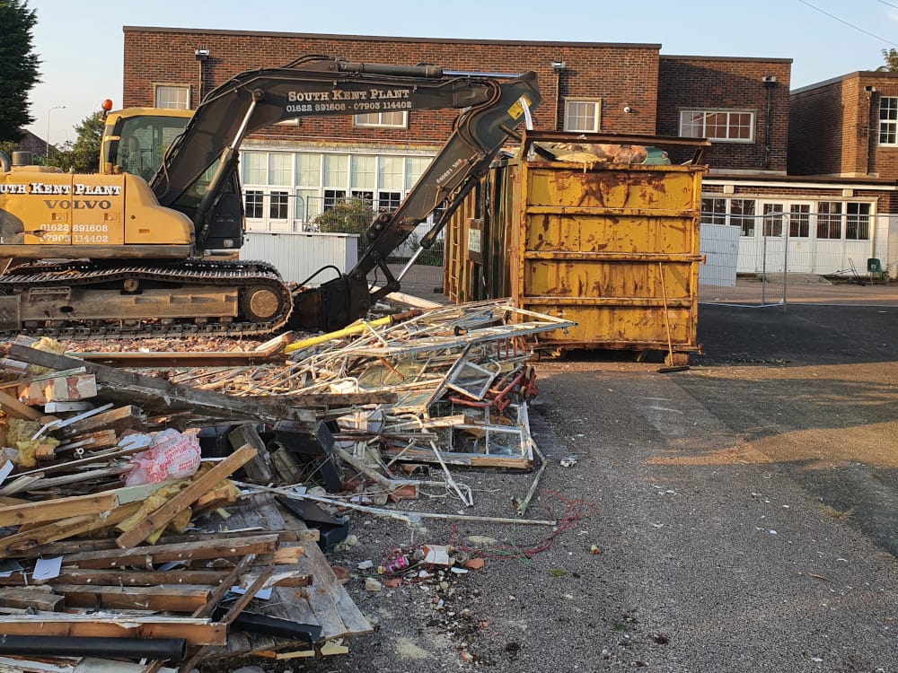
This plan is not just important for the safety of residents, farms and businesses to the east of the Rother but, as the Neighbourhood Plan allocates the former Freda Gardham site for mixed development, Rother District has stipulated that any major work there is dependent on a reduction of flood risk. East Sussex County Council, which has owned the former Freda Gardham school from the time that it was operating, has recently entered into an agreement about the site with Martelllo Developments. Future development proposals are not yet clear, but some demolition of old buildings is already under way.
It is expected that there will be a public event by the Environment Agency in the near future to enable interested parties to view the flood defence detailed proposals and latest maps of the route of those proposals.