

Worries about the landslips and the closure of Military Road dominated the open session at this week’s Rye town meeting on Wednesday March 6. Local councillors from Rye, Rother and East Sussex County Councils heard in graphic detail from a number of residents just how their lives have been affected by the recent cliff collapses.
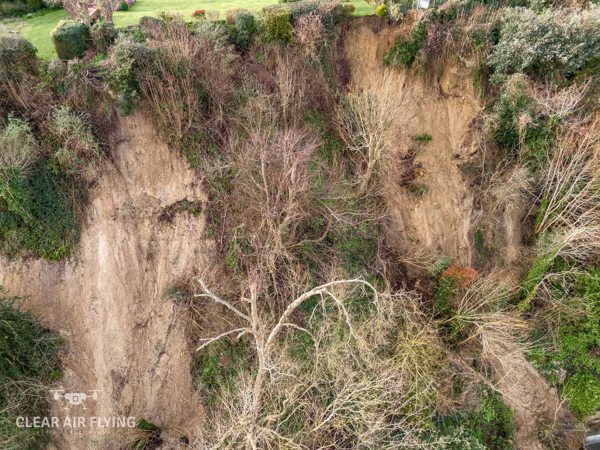
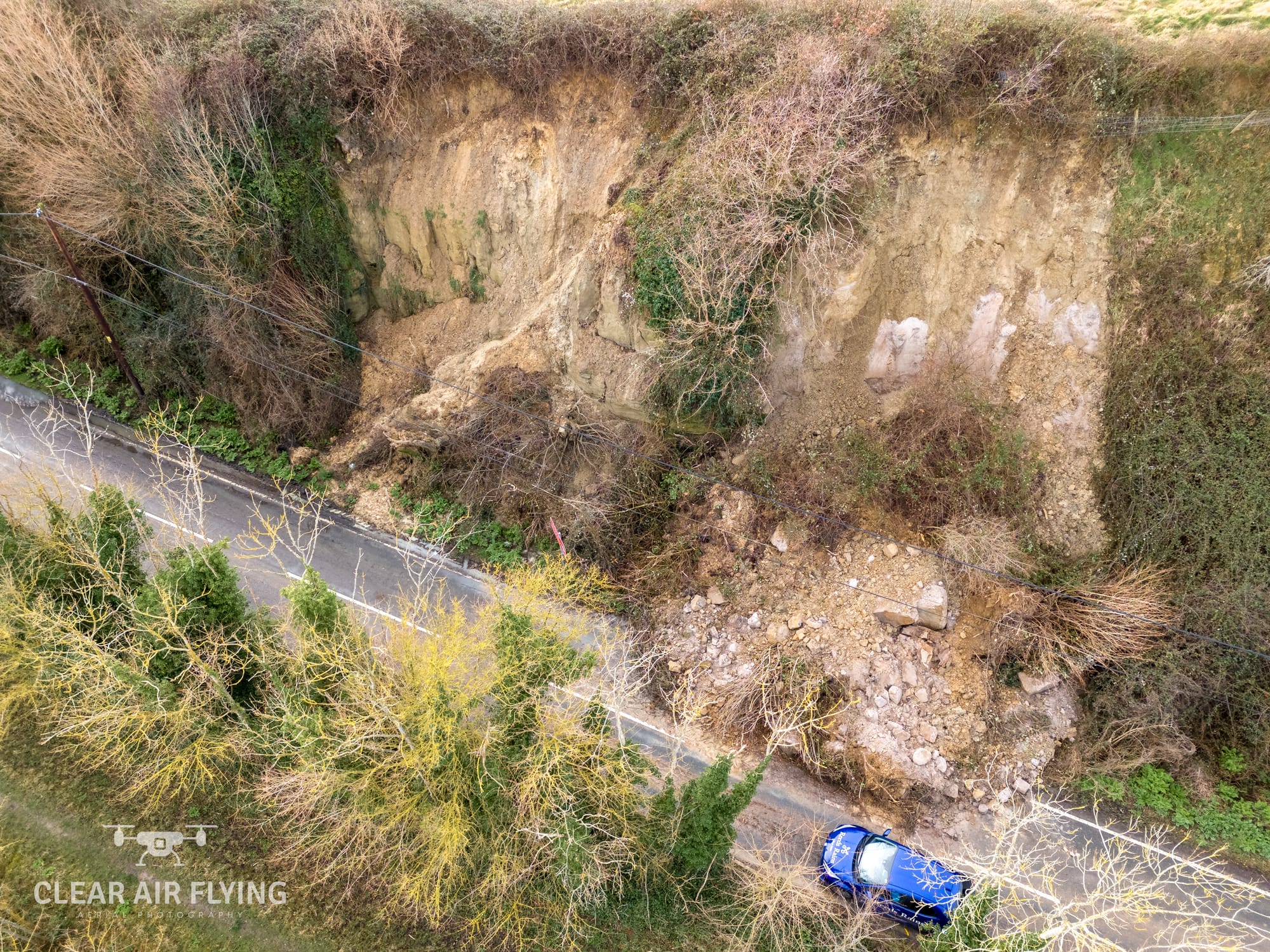
The One Network roadworks website says the road could be closed until the end of May, although this has not been confirmed by East Sussex Highways. Drone footage shows the extent of the landslips, and the danger to houses at the top and bottom of the cliffs.
[embed]https://www.youtube.com/watch?v=RyqbWm-Y51s[/embed]
Fears about how the recent planning decisions may have impacted the instability of the cliffs were discussed, along with major concerns about how people on Military Road have been left to cope. All those who spoke at the meeting raised a lack of communication from authorities as a major problem, along with worries about drainage, signage, and how future landslips will cause constant problems.
The most recent collapse occurred on Thursday February 29 near the junction of Houghton Green Road. There have also been two other major landslips in recent weeks, the first on Wednesday February 20 and last week near to 14 Military Road. A number of minor slips have also occurred, both nearby and in Winchelsea.
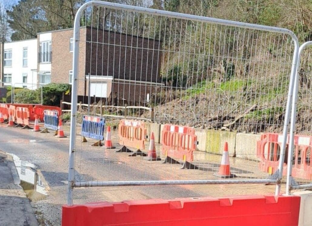
Military Road has been closed since the first landslip, with motorists and businesses facing a lengthy diversion. Heavier barriers were put in place after earlier signs and cones were moved. During the town meeting it was confirmed the latest barriers had also been moved, with cars and vans ignoring the closed signs and driving on the pavement.
Meanwhile drone shots taken by Stuart Cooper from Clear Air Flying in Winchelsea have revealed the extent of the damage caused by the landslips. The pictures and video show the large cracks in the cliff face, fallen trees, the piles of mud and rock, and also just how close the cliff edge has come to properties on Point Hill.
Investigations by East Sussex Highways engineers say the likely cause of the landslips was softer material at the top of the cliff face becoming saturated. Recent heavy rain led to the cliff becoming unstable, leading it to slump.
You can read more about Rye’s history of cliff collapses in this Rye News article by Anthony Kimber.


