
At the confluence of three rivers (Rother, Tillingham and Brede), central Rye has always had water on three sides. A short distance from the sea and sitting on a sandstone rock, Rye is subject to all the forms of flood risk: sea/tidal; river; surface, ground and sewerage. While climate change brings focus on the rise of sea level, we are experiencing more frequent extreme weather, driven by the jet stream, with the result that there are more extended bouts of heavy rainfall, causing river and ground levels to rise, surface water and the combined foul and runoff sewerage system to overload. The last two regularly cause "ponding" in well know spots and occasionally sewage spills.
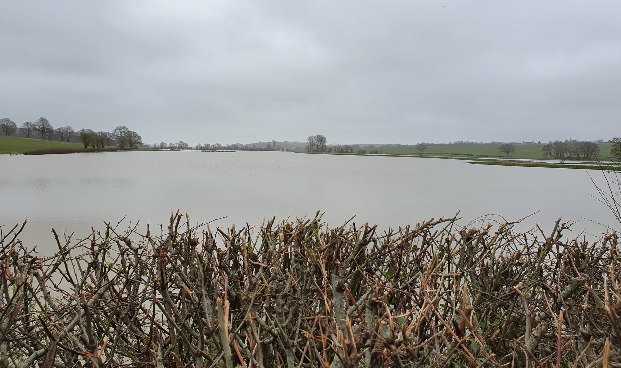
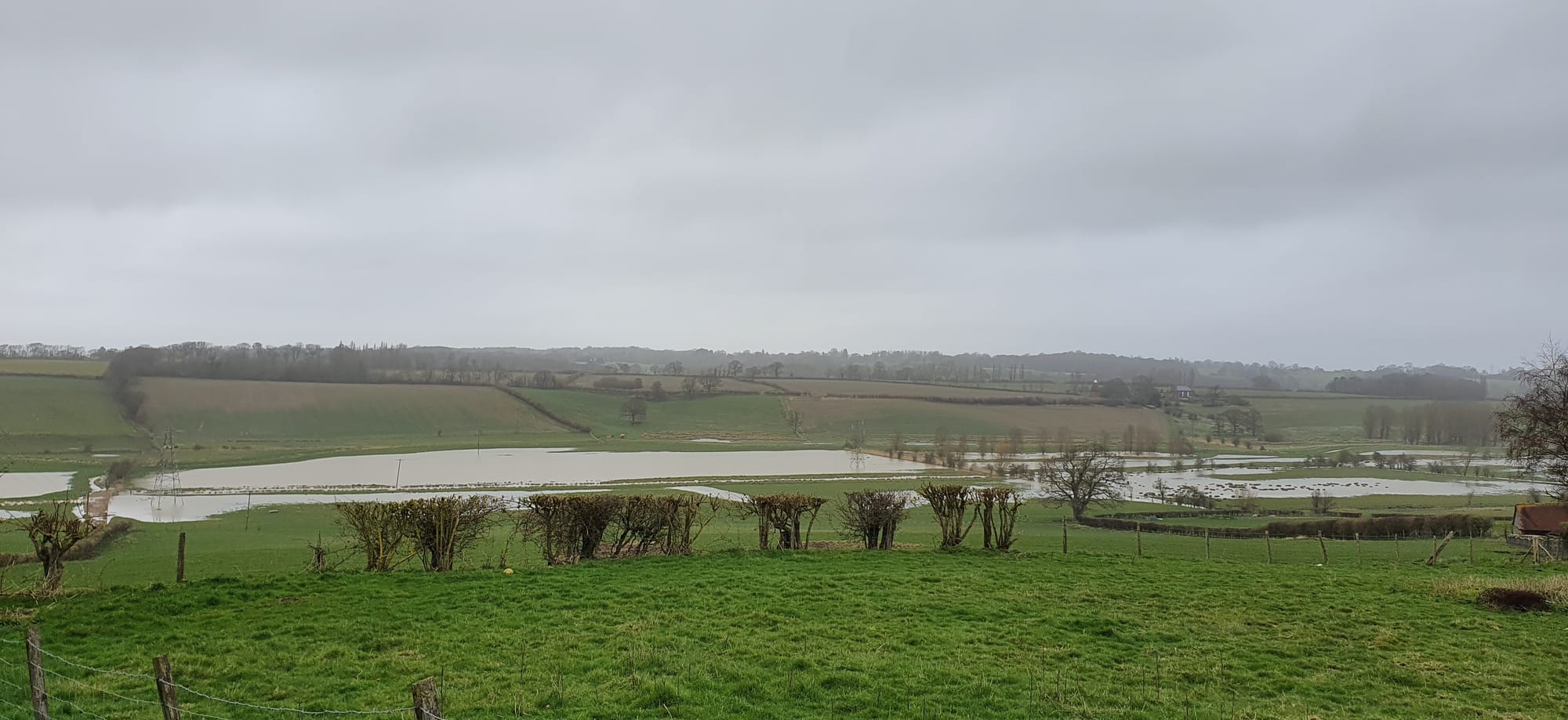
Over the night of March 5-6, the Environment Agency reported 30mm of rain in 24 hours and nearly 50mm in 48 hours. This rainfall fed all of Rye’s rivers. Fortunately, effective rural flood plains upstream allow large quantities of water to be retained before it reaches Rye and then to the sea.
When peak flows occurred on March 5-6, the upstream river gauges triggered alarms. As a result, the Environment Agency issued flood warnings for properties near both the Tillingham and Brede at Rye. Operational teams from the Environment Agency, supported by the local authority (and in Rye, the local resilience team REACT) closely monitored the situation.
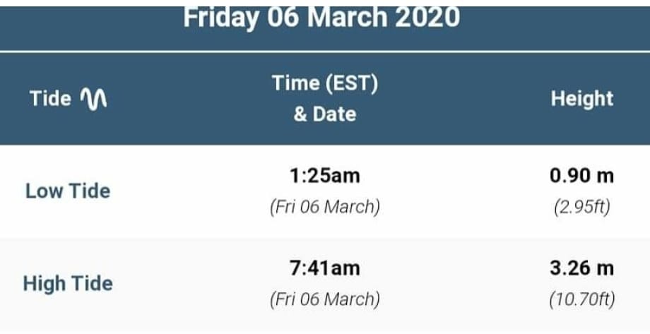
Fortunately overnight, there were low tides, allowing the water to egress through the managed tidal sluices to the sea.
Rye’s sewerage system tends to overload after heavy rainfall. The result can be spillage in places such as the around the Strand, leaving any surface water contaminated. Therefore, It is important for anyone wading in flood water to, not only be wary of submerged open drains, but to be properly protected against sewage
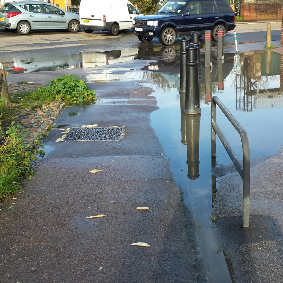
The water level rises quickly in the River Tillingham, but then tends to recover equally quickly. The Brede reacts more slowly. By the morning of the 6 March, the rain had stopped but there were large quantities of flood water upstream and significant ponding in many places around Rye.
This event, although not as serious as the recent flooding in the west and north, highlighted the very real risks affecting the many who live close to the rivers. The system can cope when all its parts operate efficiently and when peaks coincide with low tides. Of course risks increase significantly when the peak flow in the river systems coincides with high tides. Then the river sluices have to remain closed to hold the tidal water and this stops the egress of river water resulting in rising levels. In these circumstances, there are contingency plans for additional pumps and temporary flood protection barriers.
In the spirit of Alerting but not Alarming residents and businesses near the rivers and flood defence walls should maintain a simple flood kit and know whom to contact in an emergency. The Environment Agency has a Floodline: 0345 988 1188.
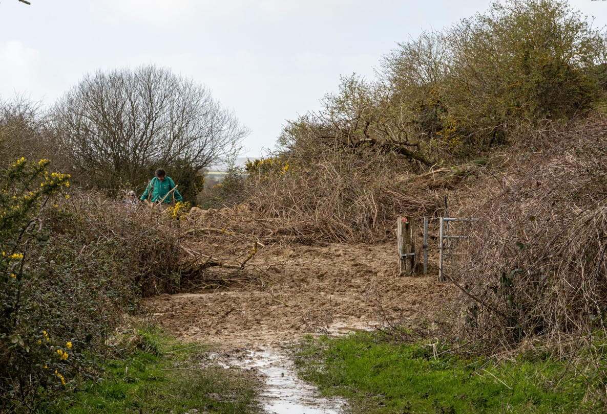
One of the consequences of the heavy rain though was that a local footpath got blocked by a landslide and Rye News reader Veryan Pollard sent us the photo above of the damage.