
The Rye Neighbourhood Plan is a “living document”, which requires periodic review to ensure that its policies are being regularly considered by Rye Town Council.
Of three recent pieces of work for the Rye Planning and Townscape Committee - affordable housing, the strategic gap with Rye Harbour, and land instability - the last has just been seen as particularly relevant by Council as there is a certain amount of vegetation removal in parts of Rye that has exposed the underlying soil and rock.
Rye stands at the point where the (mostly) sandstone high land of the Weald reaches the coast and the part of the town, known to many as the Citadel, sits on rock which has resisted coastal erosion - and it is a separated part of the high ground to the north and west of Rye that is the eastern part of the High Weald. This is made up of faulted strata of sedimentary rock known as the "Hastings Beds", the underlying structure of which is porous, relatively soft rock susceptible to water permeability and erosion - and the many springs which egress from the base of the high ground to the north of Rye result from rainwater filtered through the porous “beds” and flowing to lower points.
Landfalls and slips do happen
After extreme rainfall events – and these are becoming more frequent - or after frost and ice has acted on crevices, occasionally there are landfalls and slips at weak points on all of Rye’s south facing rock edges.
Historically, there have been large falls at places such as the western edge of Ockman Lane off East Street in the Citadel and at Point Hill, off Rye Hill, where large quantities of rock have been displaced in the past.
More recently, small falls have been seen from the Cadborough Cliff face in 2019; from above Military Road (behind the Globe and Cliff Court) in 2014, and in places below the west end of Watchbell Street and Church Square below the Gun Garden.
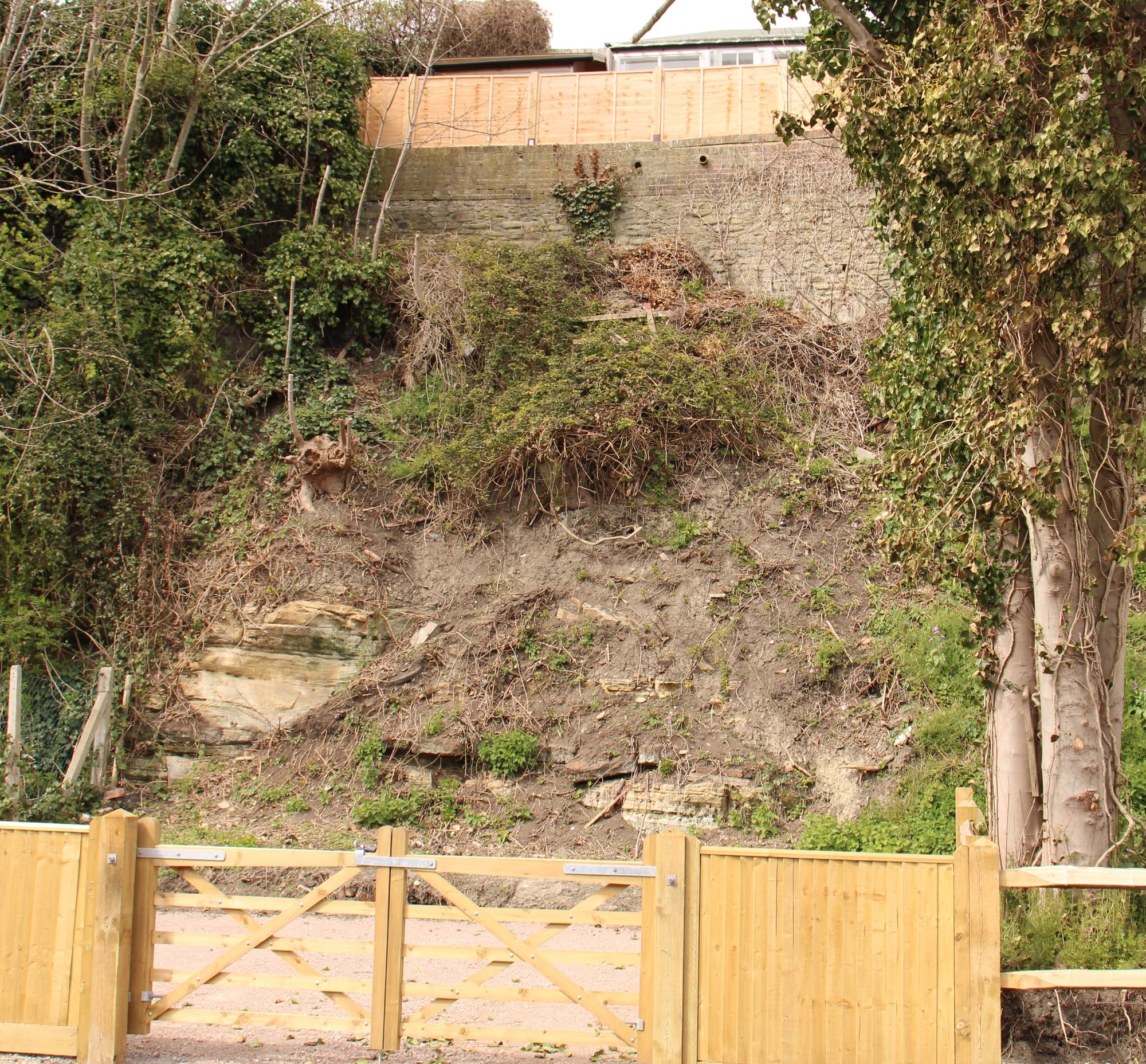
Ground works increase risk
Ground development work and the over zealous removal of vegetation risks an adverse impact on the relatively soft rock and its top soil covering - and the final result can be a higher risk of land slip. Experts in this field recommend that as much vegetation as possible should be retained to stabilise the top soil, and that storm water runoff should be carefully directed away to prevent the liquefying of top soil and the weakening of the rock under layers.
Remedial work has to be carried out by experts who do not aggravate the problem as those adding concrete might create points of new weakness into which water and ice can act.
This is a planning matter
To prevent land owners increasing the risk of instability is a planning matter and national policies and local ones in the Rother Core Strategy, the Rother Development and Site Allocation document and in the Rye Neighbourhood Plan all recognise this risk, identify high risk area locations - parts of Rye are included - and set policy to monitor and mitigate.
Planners should recognise any site specific risk and ensure that their decisions do not aggravate the situation. Where land owners take unilateral action, perhaps prior to development proposals, as seen in places now such as the Undercliff, beneath Rye Hill particularly on the north side of Military Road, and land under New England Lane (also above Military Road), their actions should be subject to enforcement action to ensure appropriate mitigation.
Rye is certainly built on rock, but it is relatively soft and permeable rock, and needs to be treated with great respect. As our forebears have seen, careless works can cause damage which could result in those on high ground ending up at sea level.