

A revised strategy for tackling Britain's coastal erosion is due out in spring 2020 from the government's Environment Agency (EA). This is supposed to cover the 80 years up to the start of the next century, 2100, following a public consultation in May 2019.
However it may be fighting a losing battle with places like Camber very much at risk from the rising tides.
EA's current map of flood risks for this area is much more focused on flooding from the rivers, not land behind sea defences, though some of that does reflect river tidal sections below the flood barriers.
Underlying that map though is a long history of land reclamation from the sea, river banks and marshes, and a past history of rivers which were once tidal quite a distance inland (as far as Bodiam for example) until they and some of our former ports simply silted up - or vanished.
Over the centuries Rye Bay has featured a number of shingle and sand banks (some now underwater), and one once housed the harbour of Old Winchelsea before it was swept away centuries ago, only for the new medieval harbour on the seaward side of the heights of today's new Winchelsea to eventually become silted up in turn.
Indeed the Norman Camber castle, on a shingle spit between Winchelsea and Rye , once overlooked a huge harbour in which the Royal Tudor fleet could shelter because it had a comparatively low draught and did not need a very deep anchorage.
And in those days Camber did not even exist - and may not again in the not very distant future - and the River Rother joined the sea at Romney rather than Rye.
So it becomes very easy to believe that William the Conqueror took the shortest possible route across the Channel in 1066, and rested overnight at sea in the shelter of a shingle bank while waiting for high tide before unloading his army in the sheltered tidal river basin between Winchelsea and Icklesham for the 1066 battle against the Saxons further upstream.
But neither did he land at Pevensey, nor was the actual battle fought at Battle, we are told. Battle was just a useful high point to put up a memorial building with navigation lights, but without archaeological evidence to prove its claim. But that's another story.
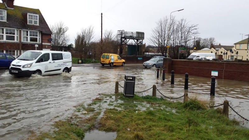
High tides today are already beginning to spill over our defences (see photo) and it may not take much of an increase in tidal levels, as a result of Arctic and Antarctic ice melting, for the Brede to become tidal again, and for the Marsh to return to how it was before the medieval reclamation started.
The EA's current flood risk maps indicate many of the low-lying areas now along our local rivers, should they become tidal again, and keeping the tide out may be an expensive proposition not only for those immediately on the coast (like Camber, Winchelsea and Pett) but also for those alongside our rivers.
For example if tidal levels keep rising it may be a pointless and expensive exercise to even plan for the (much postponed) Eastern Rother flood defences or even consider improving the existing defences on the Western banks.
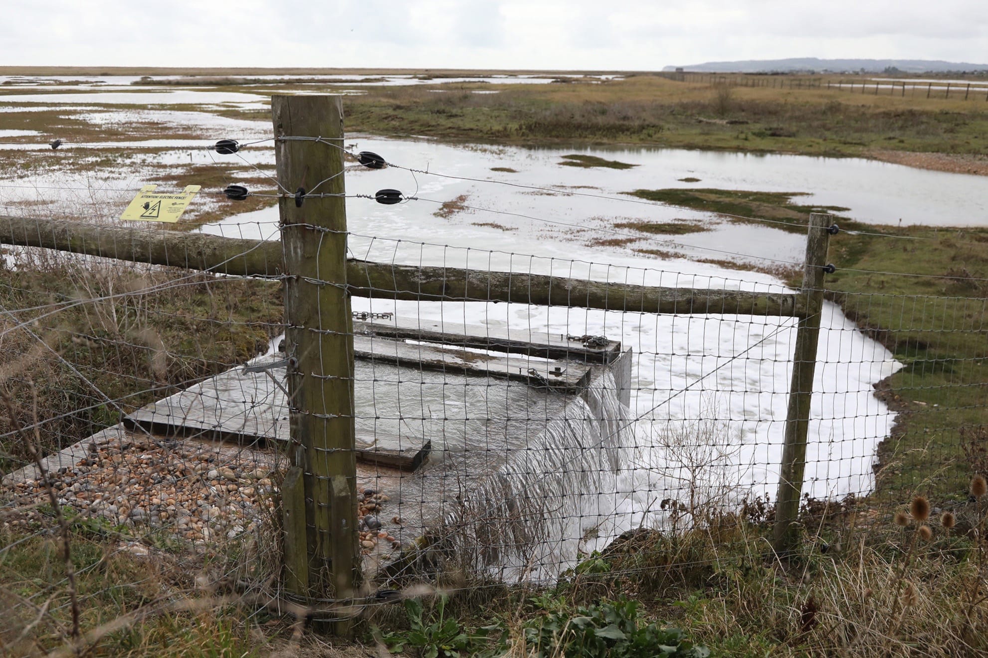
EA strategy to now has included "soak-offs" of suitable land (such as the Rye Harbour Nature Reserve) to painlessly remove the very high waters of some incoming tides (on at least two occasions since I came to Rye in 2012).
But are we really going to play "King Canute" in the face of the rising waters ? Many Pacific islanders were making the point at a pre-Christmas global climate change conference that it is already too late for them.
Satellite photos from the international space station show that we live on a globe (not a flat Earth) and that water flows between our inter-connected oceans.
Melting ice packs and glaciers (whether in the Arctic or up in the Himalayas) will have consequences therefore for every country with coastlines, and coastal towns or villages, such as Camber or Fairlight and the list goes on to include London sheltering behind an increasingly outdated Thames Barrier.


