
Last weekend flood warnings were out for the East Coast and parts of the South Coast. Spring tides augmented by a northerly wind pushing water down the North Sea and into the Channel were expected to result in a tidal surge that could have caused flooding here in Rye to the same level - and maybe even worse - than in 2013.
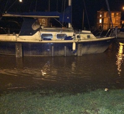
In the event, a slight change in wind direction helped the situation and although the tide was the highest since 2013, the damage caused on that occasion was fortunately not repeated.
Nevertheless the flood gates along either side of the river at Strand Quay were shut and Environment Agency officers remained on site and vigilant until around midnight on Friday, by which time the waters had reached their high point and were just starting to recede.
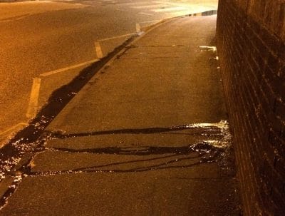
This time all was well but one point of concern, felt by this observer, was the sign of water seepage through the brickwork of the road bridge that marks the end of the Quay.
It was, as shown in the photograph (right), just a small steady trickle but one cannot help wondering if this was evidence of a potential weak spot and if the water had been higher and pressure, therefore, greater, would the retaining wall have held or would it have given way allowing the river to flow, unfettered, on to the road at Strand Quay, Winchelsea Road and other lower points?
Photos: John Minter